

Position webs.
A technique used by some lifeboat crew is to draw a web of permanent position lines on the chart, the vessel's approximate position can then be very rapidly placed on the chart.
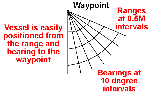
One approach to this, is to place a waypoint at some convenient spot, such as near the harbour entrance. If you then draw bearings from the waypoint out to sea at 10 degree intervals, the bearing to waypoint display will give you a bearing that will fall between two of these lines and the vessel can be positioned in one of the cones thus created.
If you have also drawn arcs at increasing intervals from the waypoint (say 0.5M), the distance off can be approximated.
Whilst this approach will not tell you where you are, it is accurate enough for most purposes. Most of the time knowing exactly where you are is not vital, by the time it is plotted on the chart the vessel has moved! As long as you know that you are in safe water, and for how long you will remain in safe you normally do not need any more.
This is especially useful when at speed or in difficult conditions.
Sailtrain.co.uk is free to use, but if you feel you would like to contribute to the running and development costs you can donate via Paypal:
