

Quick GPS position plot.
One of the main advantages of a GPS navigation system is the ability to find the vessel's latitude and longitude rapidly.
This advantage can be reduced by the time it takes to plot this position on the chart. Especially when you are in confined waters and you need to put a position on the chart quickly.
One approach is to put a waypoint at the centre of the nearest compass rose.
If the GPS is tracking this waypoint, it will be giving you the bearing and distance to the waypoint.
The vessel's position can be quickly plotted by laying a straight edge from the dot in the centre of the compass rose through the given bearing when it is read off the outer ring.
The distance from the waypoint can be quickly measured off with the dividers, and the vessel's position plotted on the chart.
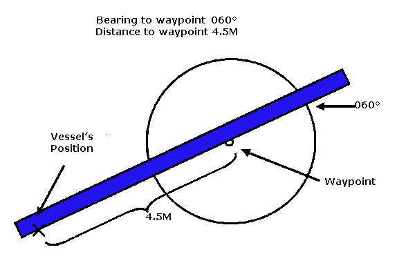
Remember that the bearing is looking towards the compass rose!
Sailtrain.co.uk is free to use, but if you feel you would like to contribute to the running and development costs you can donate via Paypal:
